
Cartistic
Endeavors
Map Art for
the Home and Office


Cape Cod
and Vicinity
circa 1900
16"w x 20"h
Encompassing the Cape as well as Martha's Vineyard and Nantucket Island, let our Historic Landscape Style (TM) transport you to a simpler time when fishermen ruled and sandy shores stretched clear.
Go to our partners at Fine Art America to order this map.
The Chesapeake Bay
and Vicinity
circa 1950
18"w x 24"h
Utilizing our unique Historic Landscape Style (TM), this full-color map covers the Chesapeake Bay and the Delmarva Peninsula, from Wilmington, Delaware in the North to Norfolk Virginia in the South.
This map includes the cities of Baltimore, Washington, and Richmond, as well as the major rivers and estuaries of the Chesapeake Basin.
Go to our partners at Fine Art America to order this map.
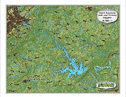
Deep Creek Lake and Surroundings
2021
20"w x 16"h
A contemporary view of Maryland’s Deep Creek Lake and State Park is shown in our Historic Landscape Style (TM).
This full-color map shows the surrounding populated areas, land use, relief and forested areas of a marvelous region of western Maryland.
Go to our partners at Fine Art America to order this map.
The East End
Long Island, N.Y.
circa 1850
20"w x 16"h
A mid-19th century period map of eastern Long Island depicted in our Historic Landscape Style (TM).
This full-color map covers both the North and South Forks, from Montauk and Orient Points to Riverhead. It includes detailed shallows of the Shinnecock, Great and Little Peconic, and Gardiners Bays while reaching into Block and Long Island Sounds.
Go to our partners at Fine Art America to order this map.
The Great South Bay
Long Island, N.Y.
circa 1900
36"w x 11.75"h
This view of Southern Long Island from 1900 shows the Great South Bay and its vicinity in our full-color Historic Landscape Style (TM). The shallow bathymetry of the bay from the barrier islands to the marshes ringing it’s shore contrasts with the small towns, fields and forests now absorbed into the suburbia of modern Long Island.
Go to our partners at Fine Art America to order this map.
The Indian River
Lagoon, Florida
circa 1885
18"w x 24"h
The largest estuary in the United States, all of its 156 miles is displayed as it was in the late 19th Century in vivid color with exquisite detail using our Historic Landscape Style (TM).
Long before the establishment of the Kennedy Space Center, pineapples were king inland from the lagoon.
Hang this map on your wall and step back into a simpler time...
Go to our partners at Fine Art America to order this map.
The Jersey Shore, Sandy Hook to Barnegat Inlet
circa 1900
10"w x 20"h
Stretching from Raritan Bay and Sandy Hook to Barnegat Inlet, this first of a 3-map set will depict the Jersey Shore in 1900 in full-color utilizing our unique Historic Landscape Style (TM).
Sea Bright, Asbury Park, Ocean Grove, Sea Girt, Seaside Park and more dotted the beaches at the turn of the last century as they still do today.
Go to our partners at Fine Art America to order this map.
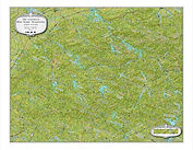
Lake George, N.Y.
and Vicinity
circa 1900
10"w x 20"h
Jewel of the Southern Adirondacks, Lake George, depicted here in our Historic Landscape Style (TM), in 1900 has color, beauty and details that will enhance any office or home wall.
See for yourself as it transports you to its crisp mountain air and sun-dappled waters, that await you on your next visit.
Go to our partners at Fine Art America to order this map.
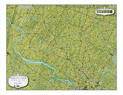
Lancaster County
Pennsylvania
2020
20"w x 16"h
Core of the Pennsylvania Dutch County, this contemporary full-color map Lancaster County, rendered in our Historic Landscape Style (TM) will transport you to green fields, and simpler ways, while bringing eye-catching beauty to any home or office.
Go to our partners at Fine Art America to order this map.
Long Island
N.Y. and Vicinity
circa 1850
36"w x 11.75"h
Hang this map on your wall and be transported back in time to when New York could fit onto Manhattan Island, Hempstead Plains was still agricultural, and the Pine Barrens seemed to stretch without end.
Captured in our Historic Landscape Style (TM) the U. S. Coast Survey preliminary charts of the region are brought to life in exquisite detail and in full-color.
A beautiful piece of cartographic art to adorn any home or office.